 |
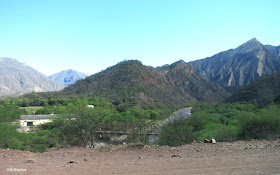
| northwest Argentina |
 |
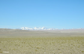
| Looking across the Chilean Altiplano |
I visited in October--spring in the Southern Hemisphere--on a Mountain Sobek tour led by Brian Weirum (link). We flew from Buenos Aires to Salta in Salta Province. The flight cruised the plains (pampas) of Argentina and then suddenly the land rose. I had thought of the Andes as The mountains of South America, but in fact a series of mountain ranges run north-south to the east of the Andes. The Nevado de Cachi range, on the west side of Salta Province, rises to 20,931' (6380 m) at their highest peak, Cumbre Liberator. The flight to Salta felt like approching Denver from the east: rolling plains abruptly became mountains, except that Denver is on the plains at the base of the mountains and Salta is in a valley beyond the first mountain range.
Salta is 1000' lower than Denver with a milder climate--almost no frosts or days in the 90s. It is also wetter with about 28" of rain a year, mostly in summer (December to March).
Much of Salta Province is drier than the city of Salta. Cafayate gets 17", almost all in the summer (link), Molinos only 6", again in summer (link)
The road south to Cafayate had glorious rock formations.
.
Through irrigation--mountain runoff runs through the region toward the Atlantic--the area is a major grape-growing region, producing Malbec and Torrentes wines. Argentines eat well and the local wines were delicious.
Like New Mexico and Arizona, when you look to unwatered vegetation, it is another story. The native plants were tough and spiny. Since it was October, most native plants were dormant, waiting for the summer rains.
One very visible plant was the cardón, the columnar cactus Echinopsis atacamensis. It looks similar to saguaro of the US southwest (Carnegiea gigantea) and the elephant cactus (also called cardón, Pachycereus pringlei) ) in Mexico. Here cardón was growing at over 10,000' in elevation. Even at 10,000', in northwestern Argentina, frosts are rare.
 |
| cardón |
 |
| Purmamarca, Argentina |
and emerged into sunlight just about at the top of the road. We crossed through a customs station where the two countries had adjacent booths in a single building.
 |
| Close to the Argentina-Chile Border, Argentina Route 52 |
 |
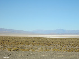
| Altiplano near Jama Pass; the flat Altiplano is about 12000' in elevation, the distant mountains are to the south |
Next week, northern Chile...
You might also like these posts
Northeastern Argentina-- Corrientes Province link

Southern Argentina - Tierra del Fuego link

Baja California - link

Northeastern Argentina-- Corrientes Province link

Southern Argentina - Tierra del Fuego link

Baja California - link


Thanks, Kathy!! I haven't even started in on my photos yet - it is fun to re-live our trip! The other Cathy
ReplyDelete